Crazy weather thread
- Thread starter beowulf
- Start date
You are using an out of date browser. It may not display this or other websites correctly.
You should upgrade or use an alternative browser.
You should upgrade or use an alternative browser.
JMCx4
Censorship is the Sincerest Form of Flattery
Please help us quantify "Crazy" in the context of this thread. Do these events qualify?
• 100.8 inches of snowfall within an 18-hour period as was reported at Capracotta, Italy, on March 5, 2015?
• A temperature of +38°C (+100.4°F) in the Arctic Russian town of Verkhoyansk on 20 June 2020, which was recognized as a new Arctic temperature record by the World Meteorological Organization (WMO)?
• A 60-minute rainfall total of 12 inches, recorded in Holt, Missouri USA on June 22, 1947?
• The Northern Hemisphere's lowest natural air temperature of -69.6°C, recorded on 22 December 1991 at Klinck station in Greenland?
• The 16.73 seconds sustained lightning bolt over northern Argentina on March 4, 2019 (with honorable mention to the 440 mile long bolt seen over Brazil on October 31, 2018)?
Vancouver Canucks
Registered User
- Feb 8, 2015
- 14,591
- 2,587
A 12-inch rainfall isn't that bad. A 4inch/hour rainfall was spotted in Dongjak-gu, Seoul in August 16, 2022.Please help us quantify "Crazy" in the context of this thread. Do these events qualify?
• 100.8 inches of snowfall within an 18-hour period as was reported at Capracotta, Italy, on March 5, 2015?
• A temperature of +38°C (+100.4°F) in the Arctic Russian town of Verkhoyansk on 20 June 2020, which was recognized as a new Arctic temperature record by the World Meteorological Organization (WMO)?
• A 60-minute rainfall total of 12 inches, recorded in Holt, Missouri USA on June 22, 1947?
• The Northern Hemisphere's lowest natural air temperature of -69.6°C, recorded on 22 December 1991 at Klinck station in Greenland?
• The 16.73 seconds sustained lightning bolt over northern Argentina on March 4, 2019 (with honorable mention to the 440 mile long bolt seen over Brazil on October 31, 2018)?
The Crypto Guy
Registered User
- Jun 26, 2017
- 26,486
- 40,343
That's quite a big difference from 12 inches in 1 hour. 4 Inches in one hour is pretty insane in itself and would lead to flash flooding, but 12 in one hour? That is just one massive flood, no way any sewage system would be able to do anything with that much water.A 12-inch rainfall isn't that bad. A 4inch/hour rainfall was spotted in Dongjak-gu, Seoul in August 16, 2022.
Last edited:
Vancouver Canucks
Registered User
- Feb 8, 2015
- 14,591
- 2,587
Yeah, there was flooding even with 4 inches/hour, but that was largely due to the giant sewage system not being constructed in time.That's quite a big difference from 12 inches in 1 hour. 4 Inches in one hour is pretty insane in itself and would lead to flash flooding, but 12 in one hour? That is just one massive flood, no way any sewage system would be able to do anything with that much water.
JMCx4
Censorship is the Sincerest Form of Flattery
Thanks for the caveat. This month & last, rainfall records in parts of the U.S. have been dropping like drunken flies, while those flies had to sober up fast & learn how to swim ...Sure to all of those but I should have said recent, as it happens. That hail was from yesterday in the middle of summer.
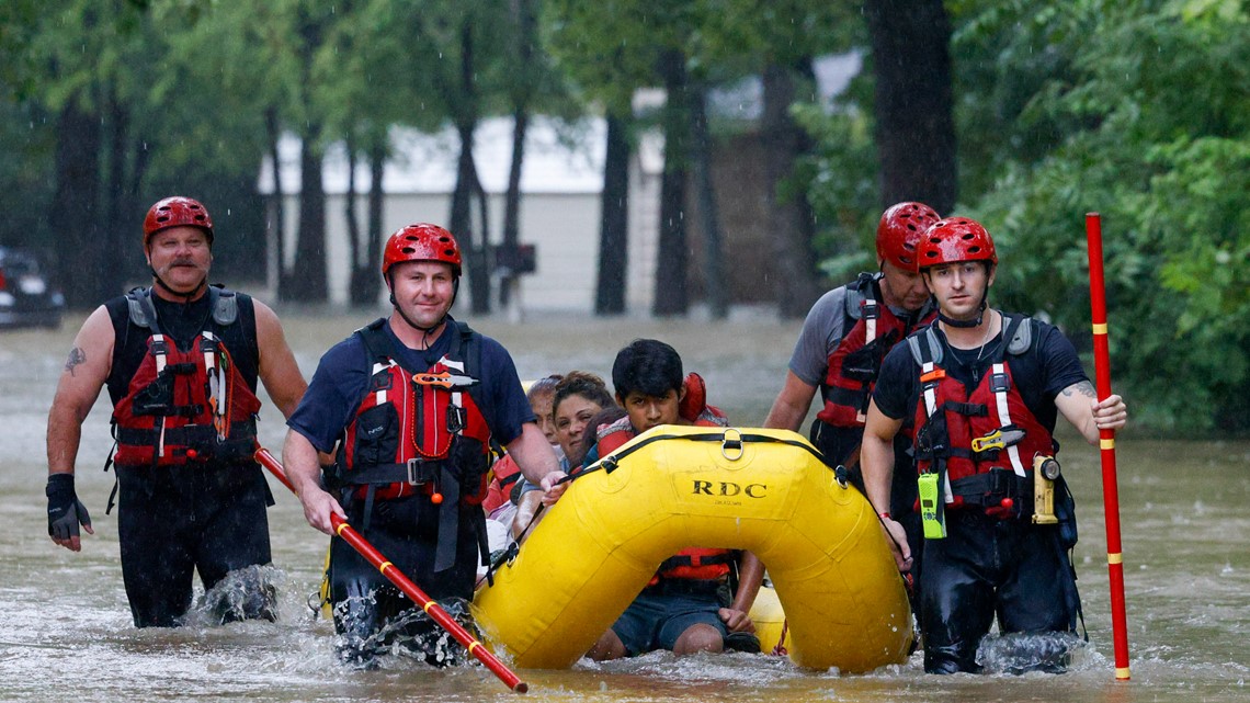
Was there also a one in a decade or century flood in Houston this week or last week?
Edit: My bad it has not caused too much trouble in Houston but many other parts of the state have been hit hard and 1 death reported so far, It was Dallas I was thinking of.
The NWS stations reported 9.19 inches of rain in the 24 hours ending at 2 p.m. Monday. That ranked second for the top 10 most rain over 24 hours in Dallas on record. The most was 9.57 inches, which fell Sept. 4 and 5 in 1932.
“It will probably put a small dent on the drought, I would imagine, but I don’t think it’s going to get rid of it by any means,” Barnes said.
 www.khou.com
Edit: My bad it has not caused too much trouble in Houston but many other parts of the state have been hit hard and 1 death reported so far, It was Dallas I was thinking of.
The NWS stations reported 9.19 inches of rain in the 24 hours ending at 2 p.m. Monday. That ranked second for the top 10 most rain over 24 hours in Dallas on record. The most was 9.57 inches, which fell Sept. 4 and 5 in 1932.
“It will probably put a small dent on the drought, I would imagine, but I don’t think it’s going to get rid of it by any means,” Barnes said.

Heavy rains cause historic, deadly flooding in Texas leading to high-water rescues
A woman, who works as an Uber driver, was killed in Mesquite when flash flooding swept her car off the Scyene Road bridge on Monday.
Last edited:
LadyStanley
Registered User
NOAA winter outlook predicts another La Niña and no end to extreme drought
Winter is coming, and U.S. forecasters are predicting that the extreme drought affecting more than half of the country will continue, especially in the West.
Which means relatively dry winter for me.
JMCx4
Censorship is the Sincerest Form of Flattery
OR it could mean record snowfall immediately followed by sub-zero temps for 6+ months. No melt, more drought.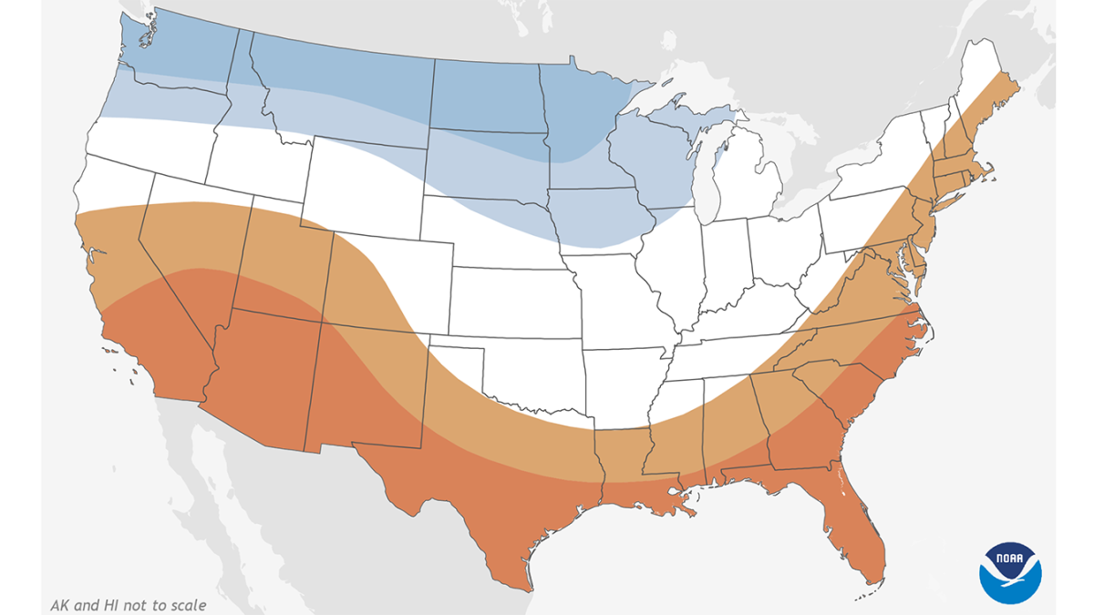
NOAA winter outlook predicts another La Niña and no end to extreme drought
Winter is coming, and U.S. forecasters are predicting that the extreme drought affecting more than half of the country will continue, especially in the West.news.yahoo.com
Which means relatively dry winter for me.
JMCx4
Censorship is the Sincerest Form of Flattery
LadyStanley
Registered User
LadyStanley
Registered User
JMCx4
Censorship is the Sincerest Form of Flattery
spintheblackcircle
My cat would be a Tkachuk
- Mar 1, 2002
- 66,402
- 14,245
spintheblackcircle
My cat would be a Tkachuk
- Mar 1, 2002
- 66,402
- 14,245
spintheblackcircle
My cat would be a Tkachuk
- Mar 1, 2002
- 66,402
- 14,245
JMCx4
Censorship is the Sincerest Form of Flattery
tacogeoff
Registered User
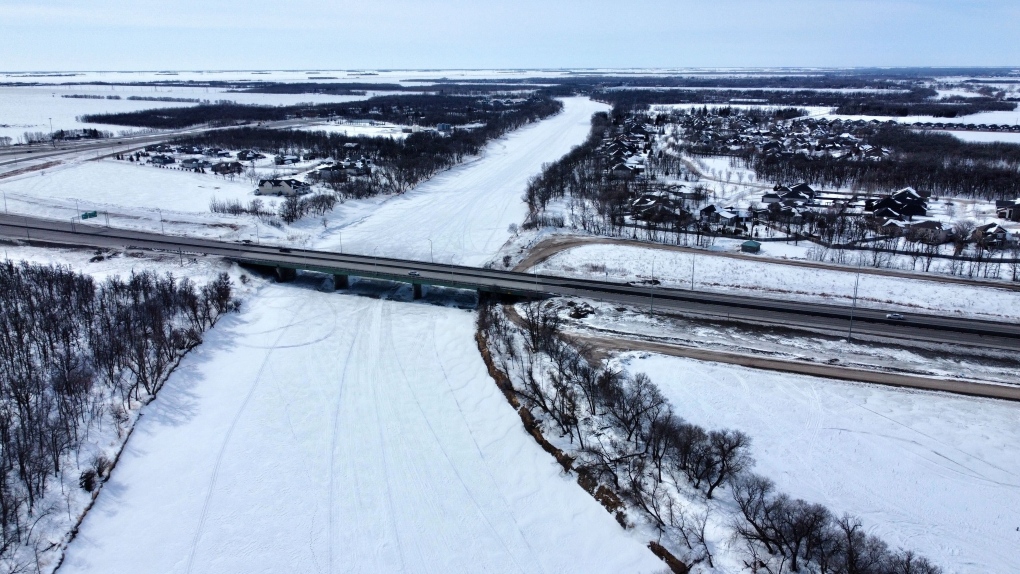
the last time a March in Winnipeg did not record a temperature above zero degrees was in 1899.
 winnipeg.ctvnews.ca

Winnipeg has not recorded a positive temperature since Valentine's Day. Here is how long the cold could last
Manitobans waiting for the temperature to warm up this spring will have to wait a little longer.
JMCx4
Censorship is the Sincerest Form of Flattery
A future entry in this thread?
Winnipeg has not recorded a positive temperature since Valentine's Day. Here is how long the cold could last
Manitobans waiting for the temperature to warm up this spring will have to wait a little longer.winnipeg.ctvnews.ca
Jay Doering, a civil engineering professor at the University of Manitoba, says a later snow melt typically means a larger peak for flooding. ...
Been annoying if not crazy at times here in Ottawa over the last 2 weeks. In the same day we have started with high winds and blizzard like snow conditions to only have it warm up to 6-7 Celsius by afternoon with the sun out and then have it drop to -10 come evening.
Speak of the devil just got an email to work from home tomorrow due to expected ice storm now.
Issued at 05:02 Tuesday 04 April 2023
Significant freezing rain and ice pellets likely, with potential ice storm conditions.
Hazards:
A prolonged period of freezing rain leading to significant ice build-up in some areas. Ice accretion of 10 to 15 millimetres is possible. Power outages and tree damage are possible.
Timing:
Starting overnight and continuing into Wednesday afternoon.
Discussion:
Ice pellets and freezing rain are expected to develop overnight or early Wednesday morning and continue for much of the day before temperatures rise above the freezing mark. Some areas may see several hours of freezing rain, which may lead to power outages and tree damage.
One potential complication is how much of the precipitation falls in the form of ice pellets versus freezing rain. If most of the precipitation falls in the form of freezing rain, this has the potential to be a significant ice storm for the region.
###
Surfaces such as highways, roads, walkways and parking lots will become icy, slippery and hazardous. Ice build-up may cause tree branches to break. Utility outages may occur.
Please continue to monitor alerts and forecasts issued by Environment Canada. To report severe weather, send an email to [email protected] or tweet reports using #ONStorm.
JMCx4
Censorship is the Sincerest Form of Flattery
From: AP News
Here’s why downpour in Florida just wouldn’t stop
By SETH BORENSTEIN
an hour ago (15 April 2023)
... Usually, thunderstorms fizzle out after they run out of rain or get cold air sucked in. But not Wednesday, when the storm that hit Fort Lauderdale had the warm and moisture-rich Gulf Stream nearby.
The end result was more than 25 inches (63.5 centimeters) of rain drenching and flooding Fort Lauderdale in six to eight hours. That ranked among the top three in major U.S. cities over a 24-hour period, behind Hilo, Hawaii’s, 27 inches (68.58 centimeters) in 2000 and Port Arthur, Texas’s 26.5 inches (67.31 centimeters) in 2017, according to weather historian Chris Burt. ...
What parked over Fort Lauderdale on Wednesday was a supercell — the type of strong thunderstorm that can spawn killer tornadoes and hail and plows across the Great Plains and Mid-South in a fierce, fast-moving but short path of destruction, several meteorologists said.
Normally a cell like that would “snuff itself out” in maybe 20 minutes or at least keep moving, (forecast branch chief at NOAA’s Weather Prediction Center Greg) Carbin said. But in Fort Lauderdale the supercell was in a lull between opposing weather systems, Carbin said. It lasted six to eight hours.
“You had this extreme warmth and moisture that was just feeding into the cell and because it had a bit of a spin to it, it was essentially acting like a vacuum and sucking all that moisture back up into the main core of the system,” said Steve Bowen, a meteorologist and chief science officer for GallagherRe, a global reinsurance broker. “It just kept reigniting itself, essentially.”
What was key, said former NOAA chief scientist Ryan Maue, was “the availability of warm ocean air from the Gulf Stream was essentially infinite.” ...
Read more at: Here's why downpour in Florida just wouldn't stop | AP News
LadyStanley
Registered User
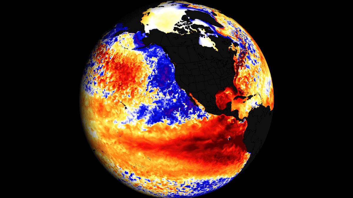
El Nino watch has been issued by NOAA, with large-scale atmospheric and oceanic changes now being detected as we head for the next ENSO phase
Weather in the United States, Canada and Europe is expected to be under the influence of an El Nino event later in the year, including Winter
El Nino forecast for 2nd half of 2023.
Users who are viewing this thread
Total: 1 (members: 0, guests: 1)
Latest posts
-
Salary Cap: Chris MacFarland - Record as Avalanche GM (Updates In First Post) (8 Viewers)
- Latest: Murzu
-
-
-


